HUNMANBY ARCHIVES
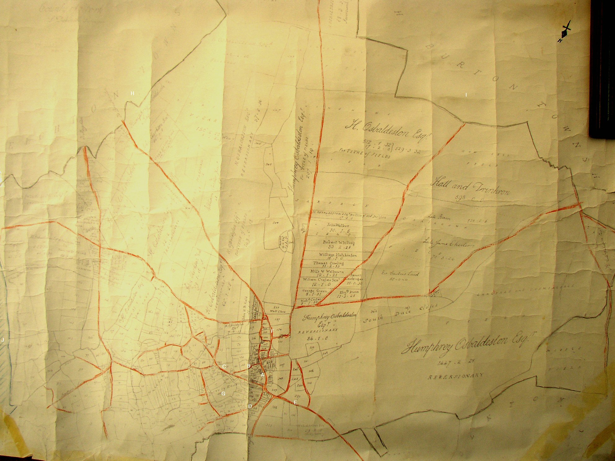
A. is position of ’All Saint’s Church’.
B. is Hungate Lane.
C. is Stonegate.
D. is Northgate.
E. is Malton Road
F. is (we believe) a ’lost’ street called Crackrop (sic) which was converted into a driveway through the newly-formed Hall Park, to Hunmanby Hall.
G. is a tract of land marked ‘Vicar by Exors’ meaning it had been left to ‘All Saint’s Church’ and is today, logically. Vicarage Close.
H. is the south-eastern boundary, beyond which is marked ‘Reighton Township’.
I. is the south-western boundary beyond which is marked ’North Burton Township’.
J. is the eastern boundary ie. Filey Bay, approximately opposite where Butlins Camp/ Amtree Park stands today.
To see this plan in more detail please save and then open in a photo programme.